


Missoula
About this
Missoula sits where the Clark Fork, Bitterroot and Blackfoot rivers meet in western Montana, with Rock Creek to the east.
Destination hub · 4 mi away in a straight line
The Bitterroot River is a freestone river in Montana, listed as Among the state's most-fished waters (agency angler survey) by Montana Fish, Wildlife & Parks.
1 USGS gauge on the water reports flow; Montana Fish, Wildlife & Parks lists 18 species, including black bullhead, brook trout and brown trout. 14 guides and 6 shops nearby are listed here; the nearest destination hub is Missoula.
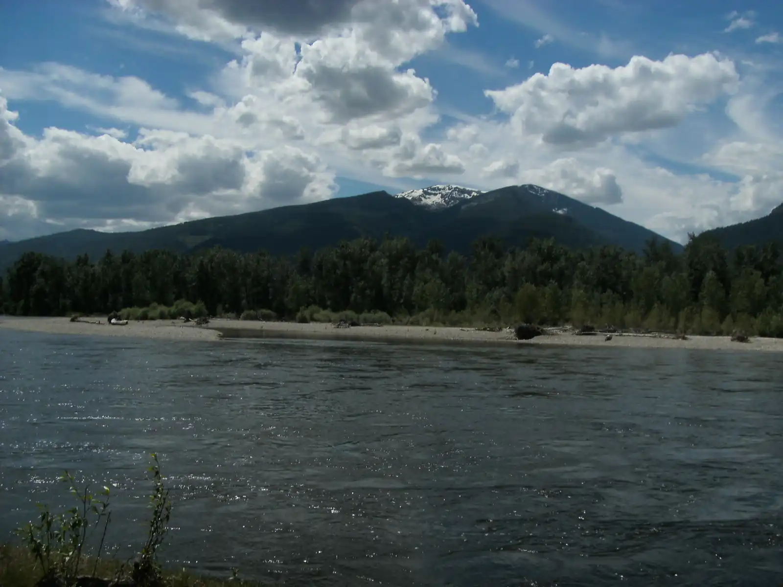
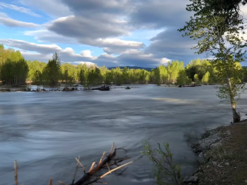
The Bitterroot River from Lee Metcalf National Wildlife Refuge, Stevensville. Photo: John David Stutts, CC BY 1.0, via Wikimedia Commons
Bitterroot River is a freestone river in Montana. Our destination hub Missoula is 4 mi away in a straight line and lists it among its waters.
Pick one of its USGS gauges and hear from us when the flow moves into or out of its usual range for the date, or crosses a flow you set. We check the public USGS reading every 2 hours and email only when it crosses, at most once every 6 hours. Flow alone is not a fishing forecast or a safety call.
Signed in: one step. Otherwise we email a confirmation link first. Every alert has one-click links to stop it.
Start from the agency's public access map. Nothing on this page grants or implies access: check the agency map, posted signs and landowner permission before you fish.
Nothing on this page grants or implies access.
Gauges, shops and guides within 40 miles
Map of Bitterroot River: gauges, shops and guides
Map of Bitterroot River with 1 USGS gauge, and shops and guides with an exact address within 40 miles.
Restrooms within 2 miles of Bitterroot River in a straight line, nearest first, with what anglers found when they went. The map says a restroom is there, not whether it is clean or open today.
Map of 6 restrooms near Bitterroot River
Skip the map; every place is in the list belowMap of 6 restrooms near Bitterroot River, numbered as in the list, with the water’s point marked.
Not rated yet — be the first to tell other anglers if it's clean.
Mapped on OpenStreetMap · see or fix it on the map
Not rated yet — be the first to tell other anglers if it's clean.
Mapped on OpenStreetMap · see or fix it on the map
Not rated yet — be the first to tell other anglers if it's clean.
Mapped on OpenStreetMap · see or fix it on the map
Not rated yet — be the first to tell other anglers if it's clean.
Mapped on OpenStreetMap · see or fix it on the map
Not rated yet — be the first to tell other anglers if it's clean.
Mapped on OpenStreetMap · see or fix it on the map
Not rated yet — be the first to tell other anglers if it's clean.
Mapped on OpenStreetMap · see or fix it on the map
Restroom locations and map details: © OpenStreetMap contributors, Open Database License, read Oct 24, 2026. Ratings, answers and photos are members' own; who shared them is never shown, and every photo is reviewed before it appears. Visits older than 18 months no longer count. Distances are straight-line miles, not driving. Nothing here grants access to private land. Community guidelines.
 Among the state's most-fished waters (agency angler survey)
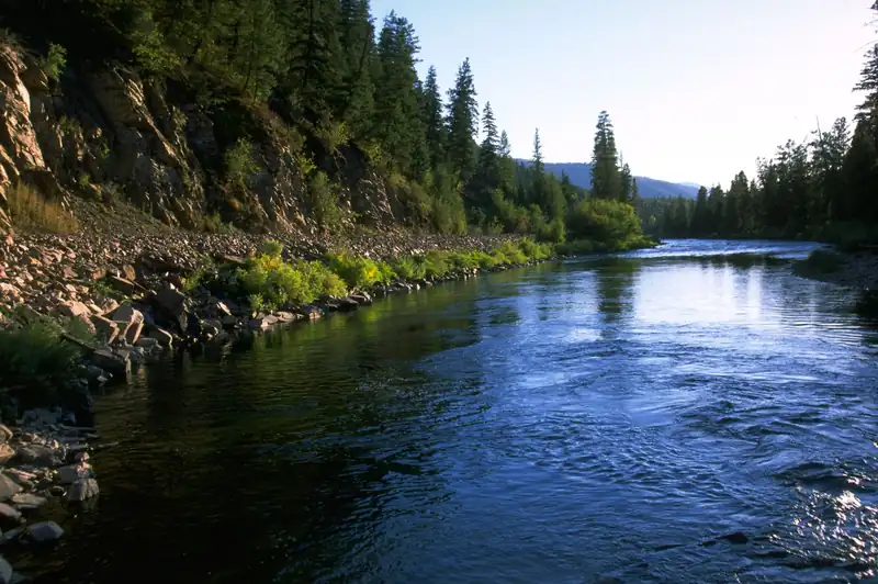
The Clark Fork in Missoula, Montana. Photo: w_lemay, CC BY-SA 2.0, via Wikimedia Commons
 Among the state's most-fished waters (agency angler survey)
The lower Blackfoot River east of Missoula. Photo: Bureau of Land Management, public domain, via Wikimedia Commons
 Among the state's most-fished waters (agency angler survey)
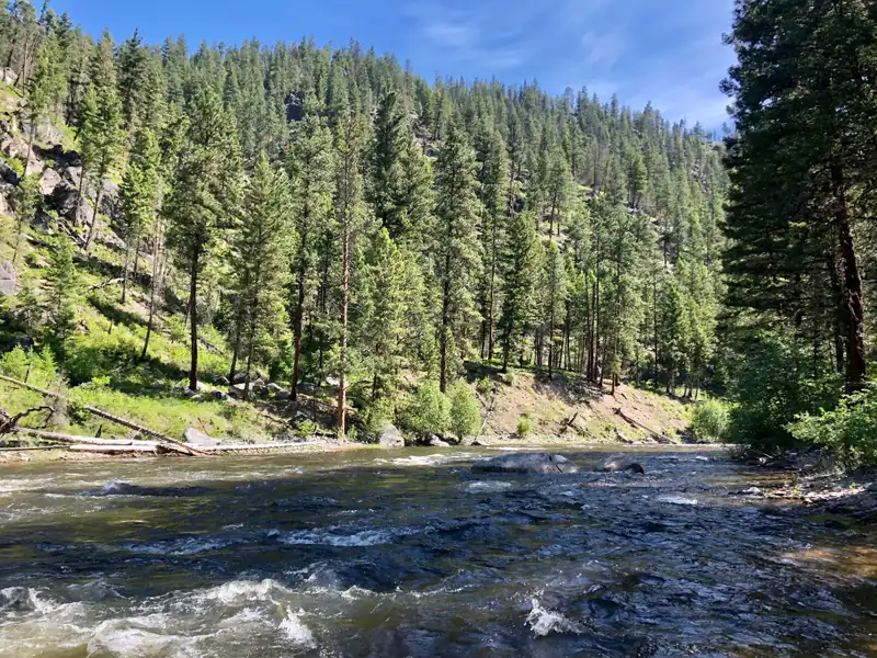
Rock Creek on the Missoula Ranger District, Lolo National Forest. Photo: USDA Forest Service, Northern Region, public domain, via Wikimedia Commons
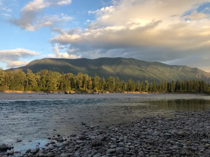 Among the state's most-fished waters (agency angler survey)Representative photo · not Lolo Creek
The Flathead River from the bank at Columbia Falls, Montana. Photo: Mitchell O'Brien, CC BY-SA 4.0, via Wikimedia Commons Not Lolo Creek.
Montana · about 14 mi
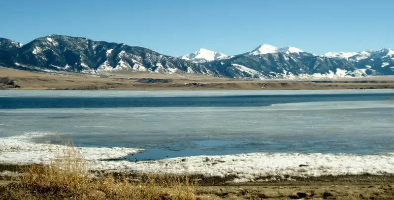 Among the state's most-fished waters (agency angler survey)Representative photo · not Frenchtown Pond
Ennis Lake, Montana, in March, with the Madison Range beyond. Photo: Gloria Cabada-Leman, CC BY 2.0, via Flickr Not Frenchtown Pond.
Montana · about 16 mi
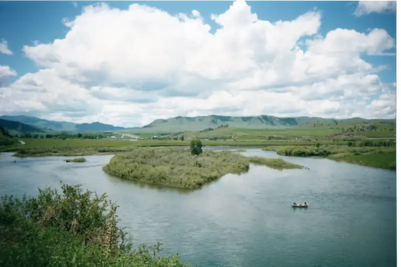 Among the state's most-fished waters (agency angler survey)Representative photo · not Jocko River
The Missouri River by the Craig Frontage Road, north of Helena (1991). Photo: Lankyrider, CC BY-SA 4.0, via Wikimedia Commons Not Jocko River.
Montana · about 25 mi
Seasons, limits, special regulations and closures for each reach are on the agency pages below. Read them before you go.
Each comes from the agency's own published list; where the list names a reach it is quoted. A designation applies to the listed reach, not necessarily the whole water. Listed in the finder under trout, bass.
On the Montana's most-fished waters (FWP statewide angling pressure estimates, 2023 license year, top 250 by state rank) list (Montana Fish, Wildlife & Parks, read 2026-11-05). All waters with this designation
On the District Exceptions to Standard Regulations (trout / gear rules) list (Montana Fish, Wildlife & Parks, read 2026-11-05). All waters with this designation
Areas the Protected Areas Database of the United States (PAD-US), public access (U.S. Geological Survey, Gap Analysis Project, read 2026-11-05) lists as owned or held in easement and open to the public, crossed by the mapped channel. Boundaries are mapped, not surveyed. Nothing on this page grants or implies access: check the agency map, posted signs and landowner permission before you fish.
Nothing on this page grants or implies access.
Listings marked Unclaimed are built from open map records and the business's own website: confirm licensing, rates, dates and hours directly.
13 guides name it on their website

Missoula, MT · 1 mi
Float trips · Wade trips · Blackfoot & Clark Fork
Names this water
Missoula, MT · 3 mi
Float trips · Lodge packages · Blackfoot & Clark Fork
Names this water
Missoula, MT · 3 mi
Float trips · Wade trips · Madison & Gallatin
Names this water

Missoula, MT · 4 mi
Beginners & lessons · Blackfoot & Clark Fork
Names this water

Missoula, MT · 9 mi
Float trips · Drift boat · Blackfoot & Clark Fork
Names this water
Stevensville, MT · 19 mi
Float trips · Beginners & lessons · Blackfoot & Clark Fork
Names this water

Clinton, MT · 20 mi
Beginners & lessons · Blackfoot & Clark Fork
Names this water
Hamilton, MT · 39 mi
Blackfoot & Clark Fork
Names this water
The species the agency lists here; presence varies by reach and season.
Listed by the state agency
Species guide
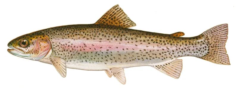
Rainbow trout (Oncorhynchus mykiss), illustration by Duane Raver for the U.S. Fish and Wildlife Service. Photo: Duane Raver, U.S. Fish and Wildlife Service, public domain, via Wikimedia Commons
Species guide
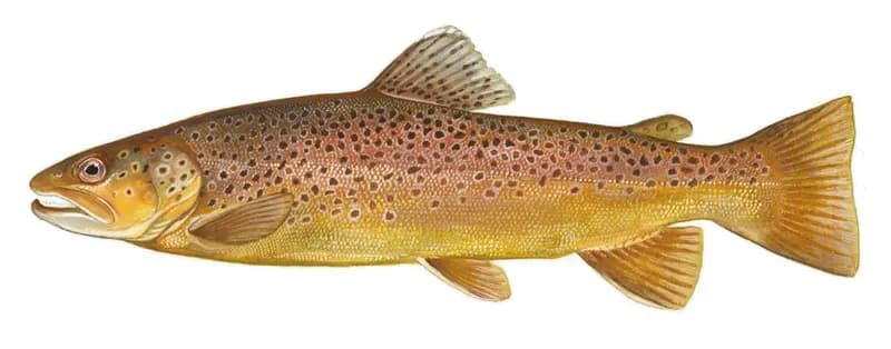
Brown trout (Salmo trutta), U.S. Fish and Wildlife Service illustration. Photo: U.S. Fish and Wildlife Service, public domain, via Wikimedia Commons
Species guide
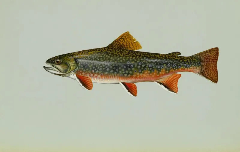
Brook trout (Salvelinus fontinalis), illustration by Duane Raver for the U.S. Fish and Wildlife Service. Photo: Duane Raver, U.S. Fish and Wildlife Service, public domain, via Wikimedia Commons
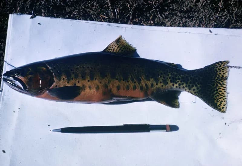
Species guide
Cutthroat trout (Oncorhynchus clarkii), photographed by James E. Johnson for the U.S. Fish and Wildlife Service. Photo: James E. Johnson, U.S. Fish and Wildlife Service, public domain, via Wikimedia Commons
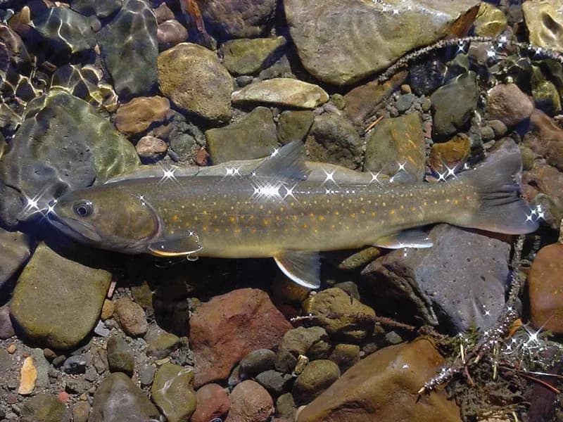
Species guide
Bull trout (Salvelinus confluentus), photographed by Bart Gammet for the U.S. Fish and Wildlife Service. Photo: Bart Gammet, U.S. Fish and Wildlife Service, public domain, via Wikimedia Commons
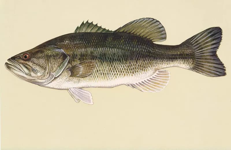
Species guide
Largemouth bass (Micropterus salmoides), illustration by Duane Raver for the U.S. Fish and Wildlife Service. Photo: Duane Raver, U.S. Fish and Wildlife Service, public domain, via Wikimedia Commons
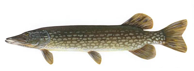
Species guide
Northern pike (Esox lucius), illustration by Timothy Knepp for the U.S. Fish and Wildlife Service. Photo: Timothy Knepp, U.S. Fish and Wildlife Service, public domain, via Wikimedia Commons
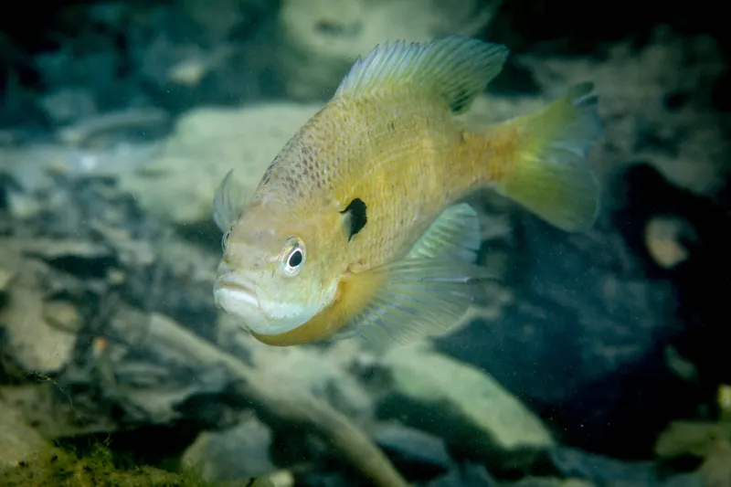
Species guide
A bluegill sunfish (Lepomis macrochirus), photographed by Ryan Hagerty for the U.S. Fish and Wildlife Service. Photo: Ryan Hagerty/USFWS, public domain, via Wikimedia Commons
And 2 more on the agency page.
5 hatches charted for the region, not measured on this water. From Montana Fish, Wildlife & Parks.
Mother's Day caddis (Grannom) (May) · Salmonfly (May to June) · Salmonfly (May to July) · Salmonfly (July) · Trico (August to September)
Missoula sits where the Clark Fork, Bitterroot and Blackfoot rivers meet in western Montana, with Rock Creek to the east.
Destination hub · 4 mi away in a straight line
Matched on the fish the agencies list for both waters first, then the same water type, an official designation or flagship listing on both, and a similar mapped size where USGS hydrography covers both.
At most two waters per country. A shared fish is a listing, not a promise: presence varies by reach and season.
Like the Bitterroot River? Same fish, overseas.
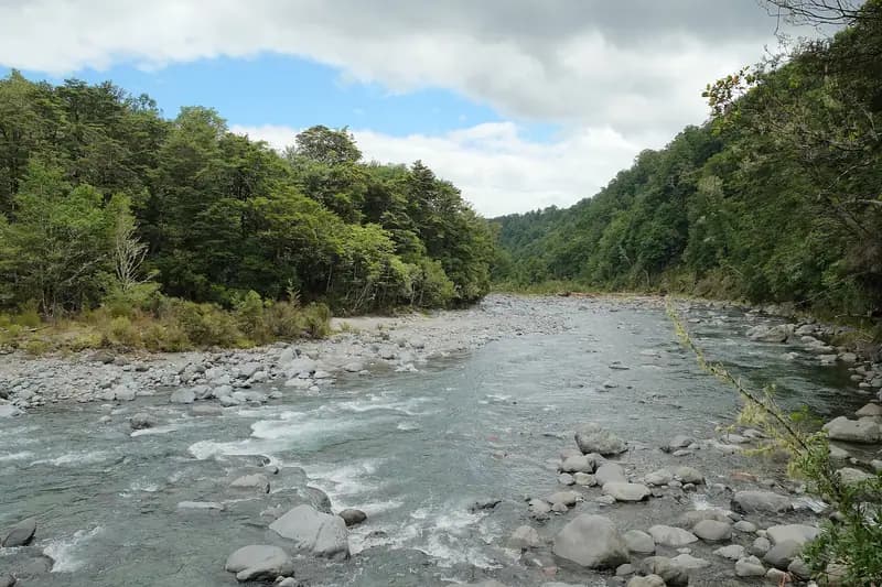 Flagship water
The Tongariro River from the Tree Trunk Gorge track. Photo: Pseudopanax at English Wikipedia, public domain, via Wikimedia Commons
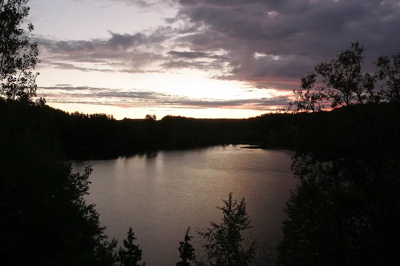 Flagship water
Daybreak on the Nipigon River. Photo: Sharon Mollerus, CC BY 2.0, via Wikimedia Commons
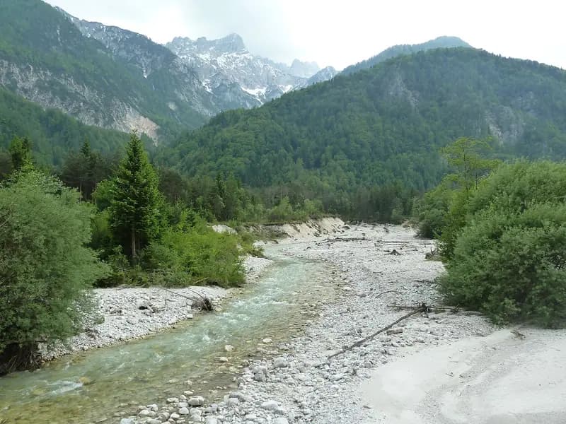 Freestone river
The Sava Dolinka below the confluence with Beli potok. Photo: Savinjc, CC BY-SA 4.0, via Wikimedia Commons
 Flagship water
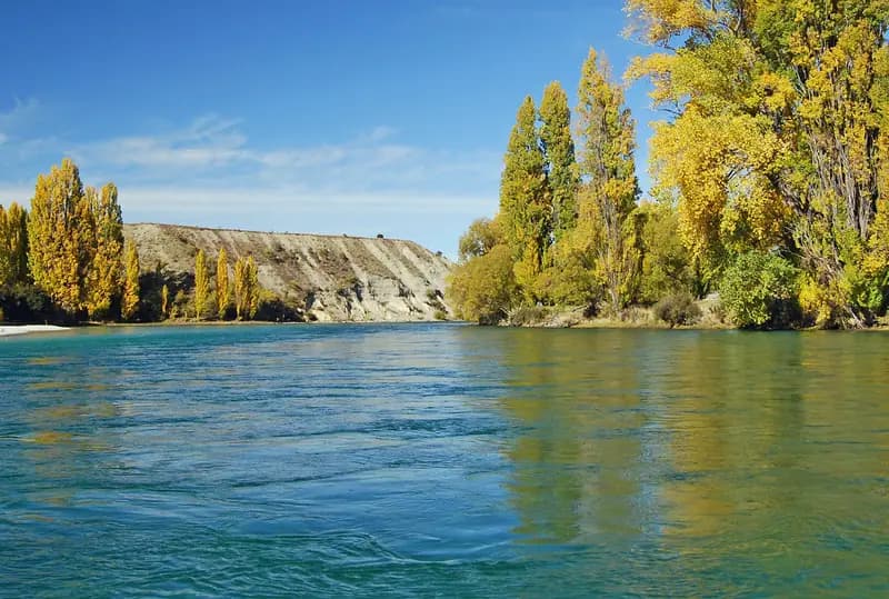
The Clutha River / Mata-Au at Albert Town, near the Hāwea confluence. Photo: Photo by Lewis: Verduyn-Cassels, CC BY-SA 3.0, via Wikimedia Commons
Otago, New Zealand
Same fish: rainbow & brown trout · also a freestone river
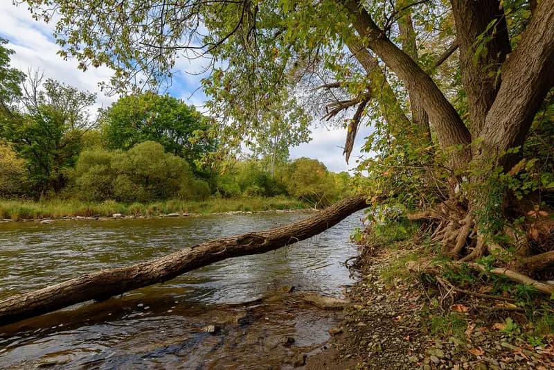 Freestone river
The Credit River at Streetsville. Photo: Mustang Joe, CC0, via Wikimedia Commons
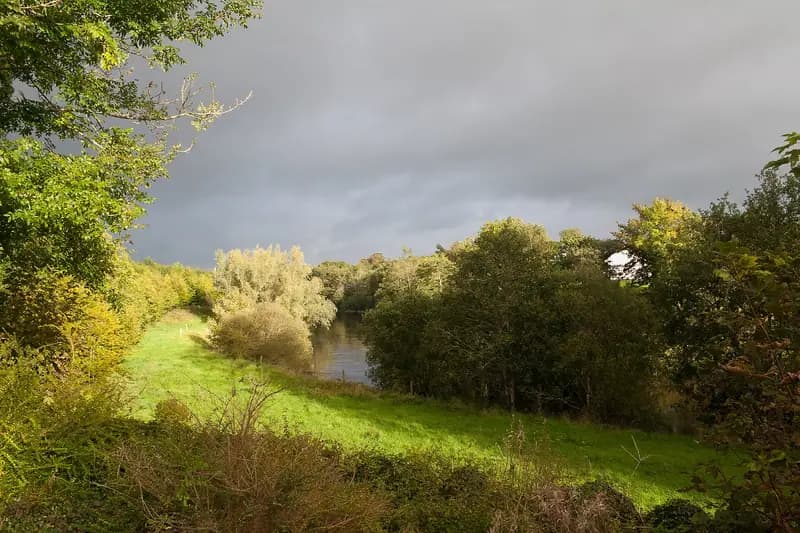 Flagship water
The River Moy at Banada Priory. Photo: Andreas F. Borchert, CC BY-SA 4.0, via Wikimedia Commons
Southern seasons open while ours close.
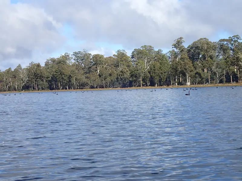 Flagship water
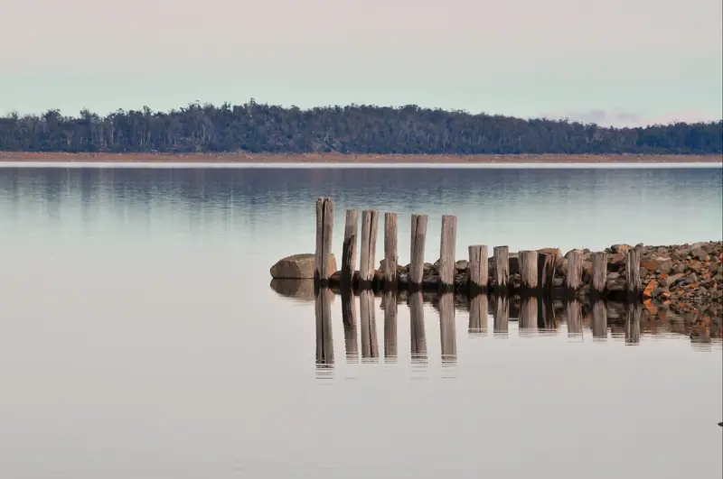
Penstock Lagoon, Central Highlands, Tasmania. Photo: Mike Cline, CC BY-SA 4.0, via Wikimedia Commons
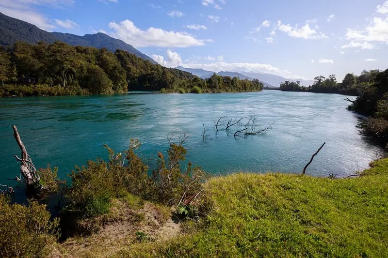 Freestone riverRepresentative photo · not Río Petrohué
The Río Puelo at Las Gualas, Cochamó. Photo: Nicolás from seno de reloncaví, Chile, CC BY-SA 2.0, via Wikimedia Commons Not Río Petrohué.
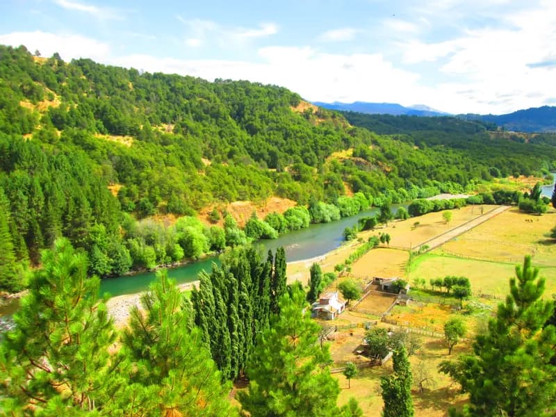 Lake or reservoirRepresentative photo · not Lago Llanquihue
The Río Simpson passing Coyhaique, Aysén. Photo: Manxuc, CC BY-SA 4.0, via Wikimedia Commons Not Lago Llanquihue.
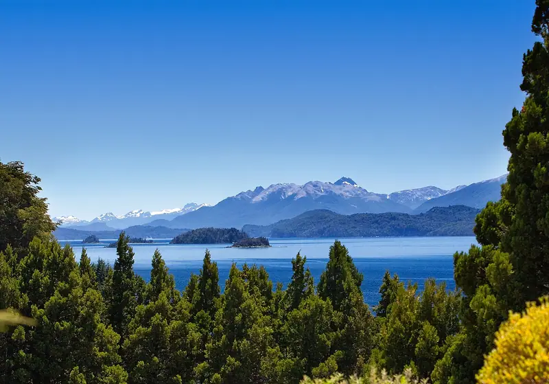 Lake or reservoir
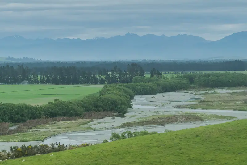 Flagship waterRepresentative photo · not Mataura River
The Oreti River near Lumsden, Southland. Photo: Krzysztof Golik, CC BY-SA 4.0, cropped, via Wikimedia Commons Not Mataura River.
 Flagship water
Great Lake, Tasmania. Photo: Peripitus, CC BY-SA 3.0, via Wikimedia Commons
A wade-fishing checklist for big western trout rivers: a 9 ft 5–6 weight outfit, nymph, dry and streamer setups, waders, boots and a wading staff, with estimated prices by tier and where to buy.
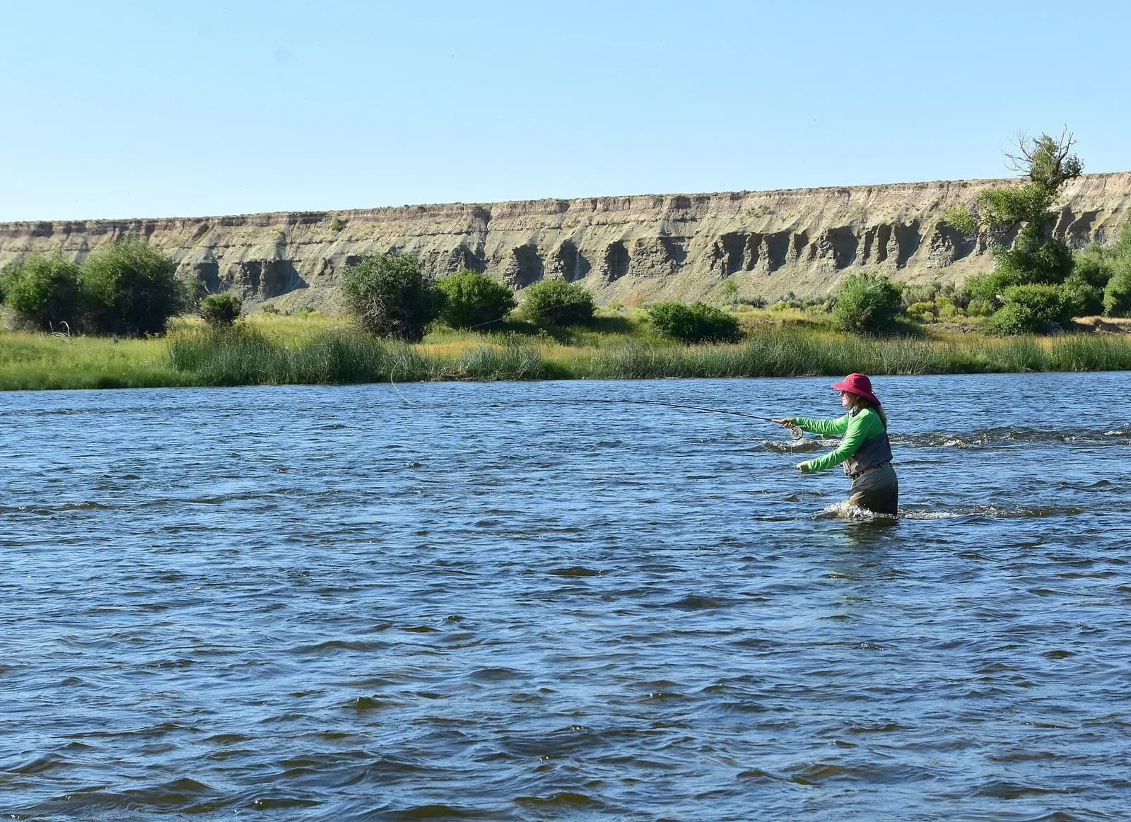
9′ rod, 5–6 weight, floating line · Rainbow and brown trout, whitefish
Open the checklistSeams, shelves and soft water, shown on real rivers.
Public YouTube videos from established channels, chosen by us to support this page. Not sponsored; the creators are not affiliated with Legendary Fly Gear.
Not sponsored All videos on reading water
Indicator rigs, depth and detecting the take.
Public YouTube videos from established channels, chosen by us to support this page. Not sponsored; the creators are not affiliated with Legendary Fly Gear.
Not sponsored All videos on nymphing
Trip stories anglers chose to share publicly and tagged with Bitterroot River.
No stories from here yet.
Not a statement of access, fish presence or conditions.
A water page organises discovery. It does not assert public access, legal access, current fish presence, guide availability or fishing conditions.
Flows, gauge statistics and flood stages come from USGS and the National Weather Service when the page is shown. Regulations, stocking, species and season statements link to the agency that publishes them; this page copies only the species names and the quoted sentences. Guide and shop listings come from the Legendary directories. Position: the USGS gauge Bitterroot River near Missoula MT. Water type is our own classification.
Limited data: Normal flow for the date: no water temperature here
No water temperature here.
At Bitterroot River near Missoula MT (USGS 12352500) Provisional USGS data
USGS 12352500 · NWS BITM8
What the agencies suggest
Carry a pocket thermometer to monitor water temperatureNational Park Service
General guidance from the readings and the published lines named above, not a fishing forecast. Local rules and closures come first.
Reading Nov 5, 3:00 PM MST · provisional USGS data
Normal for Nov 5 Steady · 24 h Below NWS action stage
Discharge, last 7 days: 168 readings from Oct 29, 5:15 PM MDT to Nov 5, 3:00 PM MST; ranging 908 to 1,020 ft³/s; latest 908 ft³/s.
USGS provisional data may be revised. Source: USGS Water Data API continuous values.
| Time | Discharge (ft³/s) | Gauge height (ft) |
|---|---|---|
| Nov 5, 3:00 PM MST | 908 | 3.36 |
| Nov 5, 2:00 PM MST | 908 | 3.36 |
| Nov 5, 1:00 PM MST | 908 | 3.36 |
| Nov 5, 12:00 PM MST | 916 | 3.37 |
| Nov 5, 11:00 AM MST | 916 | 3.37 |
| Nov 5, 10:00 AM MST | 916 | 3.37 |
| Nov 5, 9:00 AM MST | 916 | 3.37 |
| Nov 5, 8:00 AM MST | 916 | 3.37 |
| Nov 5, 7:00 AM MST | 916 | 3.37 |
| Nov 5, 6:00 AM MST | 916 | 3.37 |
| Nov 5, 5:00 AM MST | 916 | 3.37 |
| Nov 5, 4:00 AM MST | 925 | 3.38 |
| Nov 5, 3:00 AM MST | 925 | 3.38 |
| Nov 5, 2:00 AM MST | 925 | 3.38 |
| Nov 5, 1:00 AM MST | 925 | 3.38 |
| Nov 5, 12:00 AM MST | 925 | 3.38 |
| Nov 4, 11:00 PM MST | 925 | 3.38 |
| Nov 4, 10:00 PM MST | 934 | 3.39 |
| Nov 4, 9:00 PM MST | 934 | 3.39 |
| Nov 4, 8:00 PM MST | 934 | 3.39 |
| Nov 4, 7:00 PM MST | 934 | 3.39 |
| Nov 4, 6:00 PM MST | 934 | 3.39 |
| Nov 4, 5:00 PM MST | 942 | 3.4 |
| Nov 4, 4:00 PM MST | 942 | 3.4 |
| Nov 4, 3:00 PM MST | 942 | 3.4 |
| Nov 4, 2:00 PM MST | 942 | 3.4 |
| Nov 4, 1:00 PM MST | 942 | 3.4 |
| Nov 4, 12:00 PM MST | 951 | 3.41 |
| Nov 4, 11:00 AM MST | 951 | 3.41 |
| Nov 4, 10:00 AM MST | 951 | 3.41 |
| Nov 4, 9:00 AM MST | 951 | 3.41 |
| Nov 4, 8:00 AM MST | 960 | 3.42 |
| Nov 4, 7:00 AM MST | 960 | 3.42 |
| Nov 4, 6:00 AM MST | 960 | 3.42 |
| Nov 4, 5:00 AM MST | 960 | 3.42 |
| Nov 4, 4:00 AM MST | 969 | 3.43 |
| Nov 4, 3:00 AM MST | 969 | 3.43 |
| Nov 4, 2:00 AM MST | 969 | 3.43 |
| Nov 4, 1:00 AM MST | 978 | 3.44 |
| Nov 4, 12:00 AM MST | 978 | 3.44 |
| Nov 3, 11:00 PM MST | 978 | 3.44 |
| Nov 3, 10:00 PM MST | 986 | 3.45 |
| Nov 3, 9:00 PM MST | 986 | 3.45 |
| Nov 3, 8:00 PM MST | 995 | 3.46 |
| Nov 3, 7:00 PM MST | 995 | 3.46 |
| Nov 3, 6:00 PM MST | 1,000 | 3.47 |
| Nov 3, 5:00 PM MST | 1,000 | 3.47 |
| Nov 3, 4:00 PM MST | 1,000 | 3.47 |
| Nov 3, 3:00 PM MST | 1,000 | 3.47 |
| Nov 3, 2:00 PM MST | 1,000 | 3.47 |
| Nov 3, 1:00 PM MST | 1,010 | 3.48 |
| Nov 3, 12:00 PM MST | 1,010 | 3.48 |
| Nov 3, 11:00 AM MST | 1,010 | 3.48 |
| Nov 3, 10:00 AM MST | 1,010 | 3.48 |
| Nov 3, 9:00 AM MST | 1,010 | 3.48 |
| Nov 3, 8:00 AM MST | 1,010 | 3.48 |
| Nov 3, 7:00 AM MST | 1,010 | 3.48 |
| Nov 3, 6:00 AM MST | 1,010 | 3.48 |
| Nov 3, 5:00 AM MST | 1,010 | 3.48 |
| Nov 3, 4:00 AM MST | 1,010 | 3.48 |
| Nov 3, 3:00 AM MST | 1,010 | 3.48 |
| Nov 3, 2:00 AM MST | 1,010 | 3.48 |
| Nov 3, 1:00 AM MST | 1,010 | 3.48 |
| Nov 3, 12:00 AM MST | 1,010 | 3.48 |
| Nov 2, 11:00 PM MST | 1,010 | 3.48 |
| Nov 2, 10:00 PM MST | 1,010 | 3.48 |
| Nov 2, 9:00 PM MST | 1,010 | 3.48 |
| Nov 2, 8:00 PM MST | 1,010 | 3.48 |
| Nov 2, 7:00 PM MST | 1,010 | 3.48 |
| Nov 2, 6:00 PM MST | 1,010 | 3.48 |
| Nov 2, 5:00 PM MST | 1,010 | 3.48 |
| Nov 2, 4:00 PM MST | 1,020 | 3.49 |
| Nov 2, 3:00 PM MST | 1,010 | 3.48 |
| Nov 2, 2:00 PM MST | 1,010 | 3.48 |
| Nov 2, 1:00 PM MST | 1,010 | 3.48 |
| Nov 2, 12:00 PM MST | 1,010 | 3.48 |
| Nov 2, 11:00 AM MST | 1,000 | 3.47 |
| Nov 2, 10:00 AM MST | 1,000 | 3.47 |
| Nov 2, 9:00 AM MST | 1,000 | 3.47 |
| Nov 2, 8:00 AM MST | 1,000 | 3.47 |
| Nov 2, 7:00 AM MST | 995 | 3.46 |
| Nov 2, 6:00 AM MST | 995 | 3.46 |
| Nov 2, 5:00 AM MST | 995 | 3.46 |
| Nov 2, 4:00 AM MST | 995 | 3.46 |
| Nov 2, 3:00 AM MST | 995 | 3.46 |
| Nov 2, 2:00 AM MST | 986 | 3.45 |
| Nov 2, 1:00 AM MST | 986 | 3.45 |
| Nov 2, 12:00 AM MST | 986 | 3.45 |
| Nov 1, 11:00 PM MST | 978 | 3.44 |
| Nov 1, 10:00 PM MST | 978 | 3.44 |
| Nov 1, 9:00 PM MST | 969 | 3.43 |
| Nov 1, 8:00 PM MST | 969 | 3.43 |
| Nov 1, 7:00 PM MST | 960 | 3.42 |
| Nov 1, 6:00 PM MST | 960 | 3.42 |
| Nov 1, 5:00 PM MST | 960 | 3.42 |
| Nov 1, 4:00 PM MST | 951 | 3.41 |
| Nov 1, 3:00 PM MST | 951 | 3.41 |
| Nov 1, 2:00 PM MST | 951 | 3.41 |
| Nov 1, 1:00 PM MST | 951 | 3.41 |
| Nov 1, 12:00 PM MST | 951 | 3.41 |
| Nov 1, 11:00 AM MST | 942 | 3.4 |
| Nov 1, 10:00 AM MST | 934 | 3.39 |
| Nov 1, 9:00 AM MST | 925 | 3.38 |
| Nov 1, 8:00 AM MST | 925 | 3.38 |
| Nov 1, 7:00 AM MST | 925 | 3.38 |
| Nov 1, 6:00 AM MST | 916 | 3.37 |
| Nov 1, 5:00 AM MST | 916 | 3.37 |
| Nov 1, 4:00 AM MST | 916 | 3.37 |
| Nov 1, 3:00 AM MST | 916 | 3.37 |
| Nov 1, 2:00 AM MST | 916 | 3.37 |
| Nov 1, 1:00 AM MST | 925 | 3.38 |
| Nov 1, 1:00 AM MDT | 925 | 3.38 |
| Nov 1, 12:00 AM MDT | 925 | 3.38 |
| Oct 31, 11:00 PM MDT | 925 | 3.38 |
| Oct 31, 10:00 PM MDT | 925 | 3.38 |
| Oct 31, 9:00 PM MDT | 916 | 3.37 |
| Oct 31, 8:00 PM MDT | 916 | 3.37 |
| Oct 31, 7:00 PM MDT | 916 | 3.37 |
| Oct 31, 6:00 PM MDT | 916 | 3.37 |
| Oct 31, 5:00 PM MDT | 925 | 3.38 |
| Oct 31, 4:00 PM MDT | 925 | 3.38 |
| Oct 31, 3:00 PM MDT | 925 | 3.38 |
| Oct 31, 2:00 PM MDT | 925 | 3.38 |
| Oct 31, 1:00 PM MDT | 925 | 3.38 |
| Oct 31, 12:00 PM MDT | 925 | 3.38 |
| Oct 31, 11:00 AM MDT | 925 | 3.38 |
| Oct 31, 10:00 AM MDT | 925 | 3.38 |
| Oct 31, 9:00 AM MDT | 925 | 3.38 |
| Oct 31, 8:00 AM MDT | 925 | 3.38 |
| Oct 31, 7:00 AM MDT | 925 | 3.38 |
| Oct 31, 6:00 AM MDT | 925 | 3.38 |
| Oct 31, 5:00 AM MDT | 925 | 3.38 |
| Oct 31, 4:00 AM MDT | 925 | 3.38 |
| Oct 31, 3:00 AM MDT | 925 | 3.38 |
| Oct 31, 2:00 AM MDT | 925 | 3.38 |
| Oct 31, 1:00 AM MDT | 925 | 3.38 |
| Oct 31, 12:00 AM MDT | 925 | 3.38 |
| Oct 30, 11:00 PM MDT | 925 | 3.38 |
| Oct 30, 10:00 PM MDT | 925 | 3.38 |
| Oct 30, 9:00 PM MDT | 925 | 3.38 |
| Oct 30, 8:00 PM MDT | 925 | 3.38 |
| Oct 30, 7:00 PM MDT | 925 | 3.38 |
| Oct 30, 6:00 PM MDT | 925 | 3.38 |
| Oct 30, 5:00 PM MDT | 925 | 3.38 |
| Oct 30, 4:00 PM MDT | 925 | 3.38 |
| Oct 30, 3:00 PM MDT | 934 | 3.39 |
| Oct 30, 2:00 PM MDT | 934 | 3.39 |
| Oct 30, 1:00 PM MDT | 934 | 3.39 |
| Oct 30, 12:00 PM MDT | 942 | 3.4 |
| Oct 30, 11:00 AM MDT | 934 | 3.39 |
| Oct 30, 10:00 AM MDT | 934 | 3.39 |
| Oct 30, 9:00 AM MDT | 934 | 3.39 |
| Oct 30, 8:00 AM MDT | 942 | 3.4 |
| Oct 30, 7:00 AM MDT | 942 | 3.4 |
| Oct 30, 6:00 AM MDT | 942 | 3.4 |
| Oct 30, 5:00 AM MDT | 942 | 3.4 |
| Oct 30, 4:00 AM MDT | 942 | 3.4 |
| Oct 30, 3:00 AM MDT | 942 | 3.4 |
| Oct 30, 2:00 AM MDT | 942 | 3.4 |
| Oct 30, 1:00 AM MDT | 942 | 3.4 |
| Oct 30, 12:00 AM MDT | 951 | 3.41 |
| Oct 29, 11:00 PM MDT | 951 | 3.41 |
| Oct 29, 10:00 PM MDT | 951 | 3.41 |
| Oct 29, 9:00 PM MDT | 951 | 3.41 |
| Oct 29, 8:00 PM MDT | 960 | 3.42 |
| Oct 29, 7:00 PM MDT | 960 | 3.42 |
| Oct 29, 6:00 PM MDT | 960 | 3.42 |
| Oct 29, 5:15 PM MDT | 960 | 3.42 |
Normal for Nov 5: 842–1,310 ft³/s (middle half of 43 years of record). Now: 908 ft³/s, normal.
Normal for this date. 908 ft³/s is between the 25th and 75th percentiles of daily mean flow for Nov 5 at this gauge over 43 years of record: 10th 696, 25th 842, median 1,040, 75th 1,310, 90th 1,620 ft³/s.
Daily means on record for Nov 5: lowest 615 ft³/s, highest 1,870 ft³/s.
Classes as USGS labels them (hyswap: flow categories (WDFN_stats schema) (U.S. Geological Survey) ); percentiles from the USGS daily statistics (U.S. Geological Survey) (approved daily means; the reading is provisional and instantaneous).
Steady over 24 hours (−3.6% discharge). Rising or falling means a change of more than 10% in discharge (or 0.2 ft of gauge height) over 24 hours; our rule of thumb, not a USGS class.
Below NWS action stage. The National Weather Service reports this gauge below its action stage. That is not a statement that wading is safe.
NWS observed 3.37 ft stage, 916 ft³/s at Nov 5, 12:00 PM MST (NWS gauge BITM8; its stage datum can differ from the USGS gauge height).
NWS river forecast forecast issued Nov 5, 7:53 AM MST. Highest point: 3.36 ft, 908 ft³/s on Nov 5, 11:00 AM MST (Below NWS action stage).
| Day | Stage | Flow |
|---|---|---|
| Thu, Nov 5 | 3.36 ft | 908 ft³/s |
| Fri, Nov 6 | 3.35 ft | 899 ft³/s |
| Sat, Nov 7 | 3.32 ft | 874 ft³/s |
| Sun, Nov 8 | 3.3 ft | 857 ft³/s |
| Mon, Nov 9 | 3.3 ft | 857 ft³/s |
| Tue, Nov 10 | 3.3 ft | 857 ft³/s |
| Wed, Nov 11 | 3.28 ft | 840 ft³/s |
| Thu, Nov 12 | 3.28 ft | 840 ft³/s |
| Fri, Nov 13 | 3.28 ft | 840 ft³/s |
| Sat, Nov 14 | 3.27 ft | 832 ft³/s |
Open the NWS gauge page · What the categories mean (National Weather Service)
No current water-temperature reading at this gauge, so no temperature guidance is given. Take a stream thermometer: the trout lines Montana FWP uses are 66°F, 68°F and 73°F.
Species the agency lists for Bitterroot River: Black Bullhead, Brook Trout, Brown Trout, Bull Trout, Largemouth Bass, Largescale Sucker, Longnose Dace, Longnose Sucker, Mountain Whitefish, Northern Pike, Northern Pike Minnow, Peamouth, Pumpkinseed, Rainbow Trout, Redside Shiner, Slimy Sculpin, Westslope Cutthroat Trout, Yellow Perch.
Source: FISHMT :: Waterbody Details (Montana Fish, Wildlife & Parks).
Below NWS action stage. The National Weather Service reports this gauge below its action stage. That is not a statement that wading is safe.
Flood categories: action stage, minor, moderate and major flooding (National Weather Service)Turn Around Don't Drown. “A mere 6 inches of fast-moving flood water can knock over an adult.” No flow number makes a crossing safe; if in doubt, stay out.
Turn Around Don't Drown (National Weather Service)Guidance from the readings above and the published thresholds named with each line; not a fishing forecast, a safety guarantee or a statement about access. Local rules and closures come first.
Checked Nov 5, 4:11 PM MST; readings refresh at most every 15 minutes and statistics daily. Provisional USGS data can be revised. Conditions change: re-check before you go. This is general guidance, not a fishing forecast, a safety guarantee or a statement about access.
Running well nowThe Clark Fork in Missoula, Montana. Photo: w_lemay, CC BY-SA 2.0, via Wikimedia Commons
Montana · about 7 mi
Rainbow, brown & brook trout
1,620cfsFlow now · normal for the date
Running well nowThe lower Blackfoot River east of Missoula. Photo: Bureau of Land Management, public domain, via Wikimedia Commons
Montana · about 15 mi
Rainbow, brown & brook trout
648cfsFlow now · normal for the date
Among the state's most-fished waters (agency angler survey)Rock Creek on the Missoula Ranger District, Lolo National Forest. Photo: USDA Forest Service, Northern Region, public domain, via Wikimedia Commons
Montana · about 19 mi
Rainbow, brown & brook trout
286cfsFlow now · above normal for the date
Among the state's most-fished waters (agency angler survey)Representative photo · not Lolo CreekThe Flathead River from the bank at Columbia Falls, Montana. Photo: Mitchell O'Brien, CC BY-SA 4.0, via Wikimedia Commons Not Lolo Creek.
Montana · about 14 mi
Among the state's most-fished waters (agency angler survey)Representative photo · not Frenchtown PondEnnis Lake, Montana, in March, with the Madison Range beyond. Photo: Gloria Cabada-Leman, CC BY 2.0, via Flickr Not Frenchtown Pond.
Montana · about 16 mi
Among the state's most-fished waters (agency angler survey)Representative photo · not Jocko RiverThe Missouri River by the Craig Frontage Road, north of Helena (1991). Photo: Lankyrider, CC BY-SA 4.0, via Wikimedia Commons Not Jocko River.
Montana · about 25 mi