
Soča Trout Fly Fishing Slovenija
- Fly-fishing guide
- Names this water
- Saltwater & ocean charters
- Beginners & lessons
- Unclaimed
Revir Ujemi in spusti Vse ribe Najmanjša dolžina: Brez odvzema Lovni čas: 28. 3. - 1. 11.
Our translation: Catch-and-release beat: all fish; minimum size: no harvest; fishing period: 28 March - 1 November.
Set for the waters Ribiška družina Tolmin manages (one fishing period for its beats; the page does not name each river beside it).
Exceptions on the page:
Ribolovna sezona na Jezeru Revir Soča jezero obsega območje od sotočja s Tolminko do sotočja Idrijce z Bačo in do jezu v Podselu in traja od 1. marca do 30. novembra.Pravila ribolova - Tolmin
Ribiška družina Tolmin · checked 2026-11-04. Dates change each season: confirm them there.
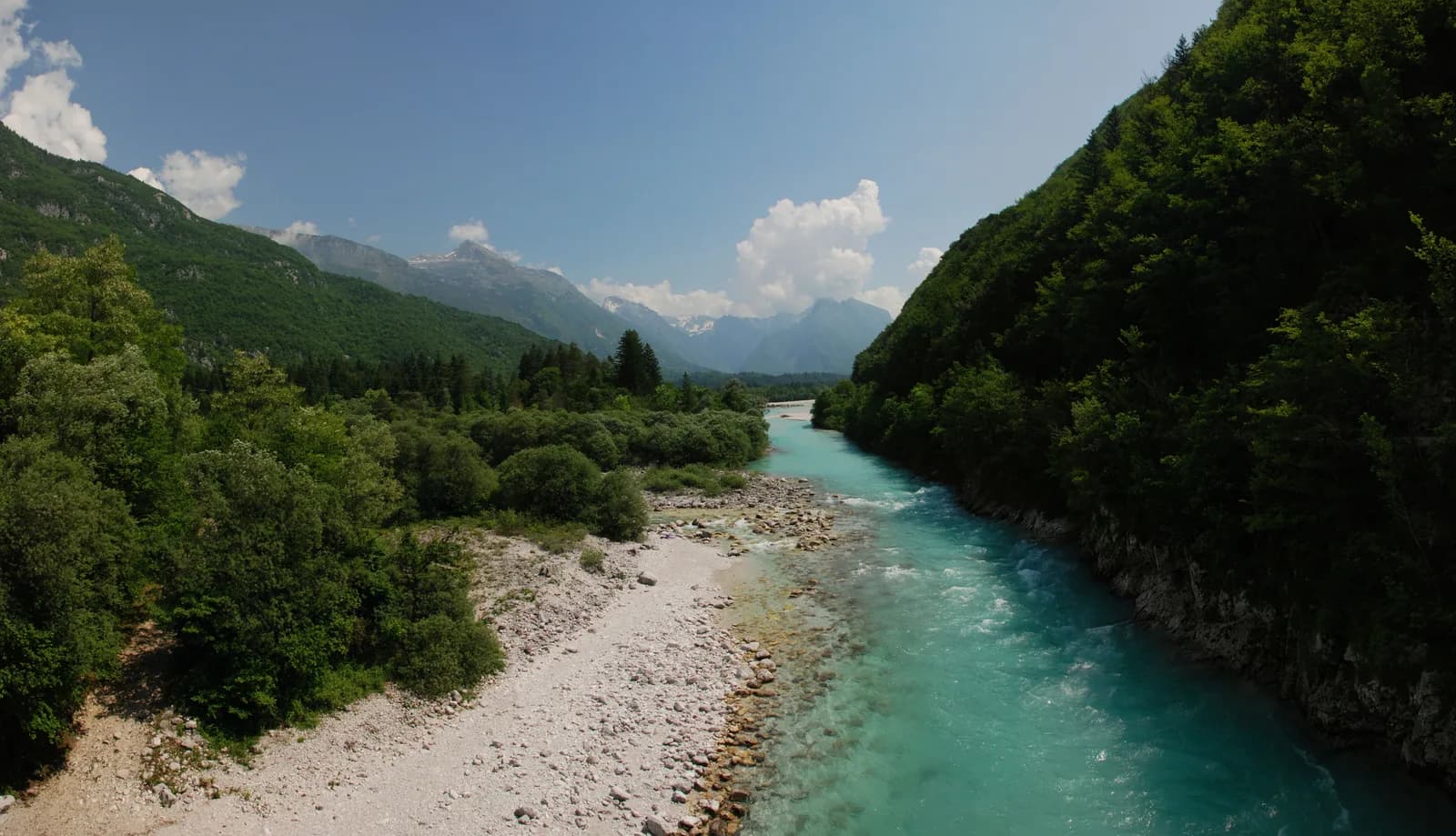
The Soča near Bovec, Slovenia. Photo: MarcusObal, CC BY-SA 3.0, via Wikimedia Commons
The Soča is a freestone river in the Goriška region of Slovenia. Ribiška družina Tolmin, the Tolmin angling club, runs it as one of its fisheries and sells permits per beat. The clubs' online permit shop, ribiskekarte.si, lists it. This page covers the Soča from Bovec through Kobarid to Tolmin and Most na Soči, the stretch Ribiška družina Tolmin sells permits for. Also called Isonzo.
Nothing on this page grants or implies access: check the agency map, posted signs and landowner permission before you fish. Most waters here need a rod licence or permit and often a beat booking or club ticket; the listing pages under Regulations say which.
Nothing on this page grants or implies access.
Gauges, shops and guides nearby
Map of Soča: gauges, shops and guides
Map of Soča with 3 gauges.
Restrooms within 2 miles of Soča in a straight line, nearest first, with what anglers found when they went. The map says a restroom is there, not whether it is clean or open today.
Map of 6 restrooms near Soča
Skip the map; every place is in the list belowMap of 6 restrooms near Soča, numbered as in the list, with the water’s point marked.
Not rated yet — be the first to tell other anglers if it's clean.
Mapped on OpenStreetMap · see or fix it on the map
Not rated yet — be the first to tell other anglers if it's clean.
Mapped on OpenStreetMap · see or fix it on the map
Not rated yet — be the first to tell other anglers if it's clean.
Mapped on OpenStreetMap · see or fix it on the map
Not rated yet — be the first to tell other anglers if it's clean.
Mapped on OpenStreetMap · see or fix it on the map
Not rated yet — be the first to tell other anglers if it's clean.
Mapped on OpenStreetMap · see or fix it on the map
Not rated yet — be the first to tell other anglers if it's clean.
Mapped on OpenStreetMap · see or fix it on the map
Restroom locations and map details: © OpenStreetMap contributors, Open Database License, read Oct 24, 2026. Ratings, answers and photos are members' own; who shared them is never shown, and every photo is reviewed before it appears. Visits older than 18 months no longer count. Distances are straight-line miles, not driving. Nothing here grants access to private land. Community guidelines.
Each line is an official list that names this water. Those pages are the authority on seasons, licences, limits and closures for each beat or reach; read them before you go.
Listings are unclaimed: confirm licensing, rates, dates and hours directly.
5 guides name it on their website
The species the agency lists here; presence varies by reach and season.
Listed by the agency
A wade-fishing checklist for big trout rivers: a 9 ft 5–6 weight outfit, nymph, dry and streamer setups, waders, boots and a wading staff, with estimated prices by tier and where to buy.
9′ rod, 5–6 weight, floating line · Rainbow and brown trout, whitefish
Open the checklistSeams, shelves and soft water, shown on real rivers.
Public YouTube videos from established channels, chosen by us to support this page. Not sponsored; the creators are not affiliated with Legendary Fly Gear.
Not sponsored All videos on reading water
Indicator rigs, depth and detecting the take.
Public YouTube videos from established channels, chosen by us to support this page. Not sponsored; the creators are not affiliated with Legendary Fly Gear.
Not sponsored All videos on nymphing
Trip stories anglers chose to share publicly and tagged with Soča.
No stories from here yet.
Not a statement of access, fish presence or conditions.
A water page organises discovery. It does not assert public access, legal access, current fish presence, guide availability or fishing conditions.
Live readings come from the named provider when the page is shown, under the licence shown on each card. Designations, species and the flagship note link to the agency or body that publishes them; this page copies only the list wording and the species names. Guide and shop listings come from the Legendary directories. Position: the gauge Soča - Kobarid I. Water type is our own classification.
Agencija RS za okolje (ARSO) publishes no record for the date to compare it with, so there is no verdict.
At Soča - Kobarid I (Agencija RS za okolje (ARSO) station 8080) · 1 of 3 gauges below
Agencija RS za okolje (ARSO) · station 8080
Reading Nov 5, 11:30 PM GMT+1
Level is gauge zero 194.94 m above sea level; it is not a depth.
Agencija RS za okolje (ARSO) · station 8031
Upstream of Bovec, above the Koritnica
Reading Nov 5, 11:30 PM GMT+1
Level is gauge zero 401.57 m above sea level; it is not a depth.
Agencija RS za okolje (ARSO) · station 8060
Between Bovec and Kobarid
Reading Nov 5, 11:30 PM GMT+1
Level is gauge zero 339.3 m above sea level; it is not a depth.
Readings refresh at most every 15 minutes and are the providers' own provisional values, shown as published. Imperial figures are converted from the metric reading for comparison only.
Tolmin, Goriška, Slovenia
River cabins · 6.0 mi
Tolmin, Goriška, Slovenia
River cabins · 14 mi