
Tropical Sportfisher
- Fly & conventional fishing guide
- Names this water
- Walk-and-wade
- Saltwater & ocean charters
- Unclaimed
Lake Morris (Copperlode Falls Dam) • Lenthalls Dam • Peter Faust Dam • Teemburra Dam • Tinaroo Dam • Wuruma Dam.
Set for this water by name. The page states no clear months, so none are shown.
Exceptions on the page:
(2) For subsection (1)(a), the regulated period is from 1 November to 31 January.
(a) take no more than 1 barramundi in a prescribed barramundi waterway within the regulated waters under section 20 or 21; or (b) possess a barramundi taken under paragraph (a). (2) However, subsection (1) applies only if the recreational fisher does not possess the barramundi while taking fish in the regulated waters, other than a prescribed barramundi waterway.
Fisheries Declaration 2019 (SL 2019 No. 76), current as at 25 September 2026
Queensland Government (Office of the Queensland Parliamentary Counsel) · checked 2026-11-04. Dates change each season: confirm them there.
The Bureau of Meteorology's data is not shown until its reuse terms are confirmed (it asks automated access to stop). We show no number rather than a guessed one.
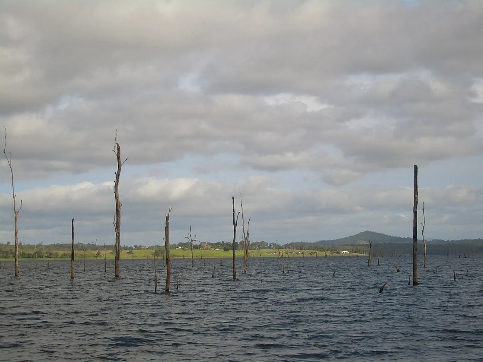
Lake Tinaroo, with the tops of trees drowned when it filled. Photo: Vmenkov, CC BY-SA 3.0, via Wikimedia Commons
Tinaroo Falls Dam is a reservoir in Queensland, Australia. The Queensland Government lists it as a Stocked Impoundment Permit Scheme (SIPS) location. It is a stocked impoundment in the Northern and Gulf catchment, on the Atherton Tableland.
Nothing on this page grants or implies access: check the agency map, posted signs and landowner permission before you fish. Most waters here need a rod licence or permit and often a beat booking or club ticket; the listing pages under Regulations say which.
Nothing on this page grants or implies access.
Restrooms within 2 miles of Tinaroo Falls Dam in a straight line, nearest first, with what anglers found when they went. The map says a restroom is there, not whether it is clean or open today.
No restroom mapped within 2 mi yet — add one you know.
Campgrounds, fishing access sites and boat ramps often have one that isn't on the map yet.
Restroom locations and map details: © OpenStreetMap contributors, Open Database License, read Oct 24, 2026. Ratings, answers and photos are members' own; who shared them is never shown, and every photo is reviewed before it appears. Visits older than 18 months no longer count. Distances are straight-line miles, not driving. Nothing here grants access to private land. Community guidelines.
Each line is an official list that names this water. Those pages are the authority on seasons, licences, limits and closures for each beat or reach; read them before you go.
Listings are unclaimed: confirm licensing, rates, dates and hours directly.
2 guides name it on their website
No shop nearby yet.
The species the agency lists here; presence varies by reach and season.
Listed by the agency
A stillwater fly-fishing checklist for lakes and ponds: a 9–10 ft 5–6 weight rod, floating and intermediate lines, chironomids and leeches, and float-tube options, with estimated prices and where to buy.
9′–10′ rod, 5–6 weight, floating + intermediate lines · Rainbow, brook and brown trout in lakes
Open the checklistChironomids, leeches and where fish hold in a lake.
Public YouTube videos from established channels, chosen by us to support this page. Not sponsored; the creators are not affiliated with Legendary Fly Gear.
Not sponsored All videos on stillwater
Trip stories anglers chose to share publicly and tagged with Tinaroo Falls Dam.
No stories from here yet.
Not a statement of access, fish presence or conditions.
A water page organises discovery. It does not assert public access, legal access, current fish presence, guide availability or fishing conditions.
Live readings come from the named provider when the page is shown, under the licence shown on each card. Designations, species and the flagship note link to the agency or body that publishes them; this page copies only the list wording and the species names. Guide and shop listings come from the Legendary directories. Position: the OpenStreetMap feature “Lake Tinaroo, Kairi, Queensland, 4872, Australia” (© OpenStreetMap contributors, ODbL), found with Nominatim; a point on or near the named feature, approximate. Water type is our own classification.