
Lakes & stillwater
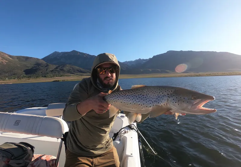
9′–10′ rod, 5–6 weight, floating + intermediate lines · Rainbow, brook and brown trout in lakes
Open checklist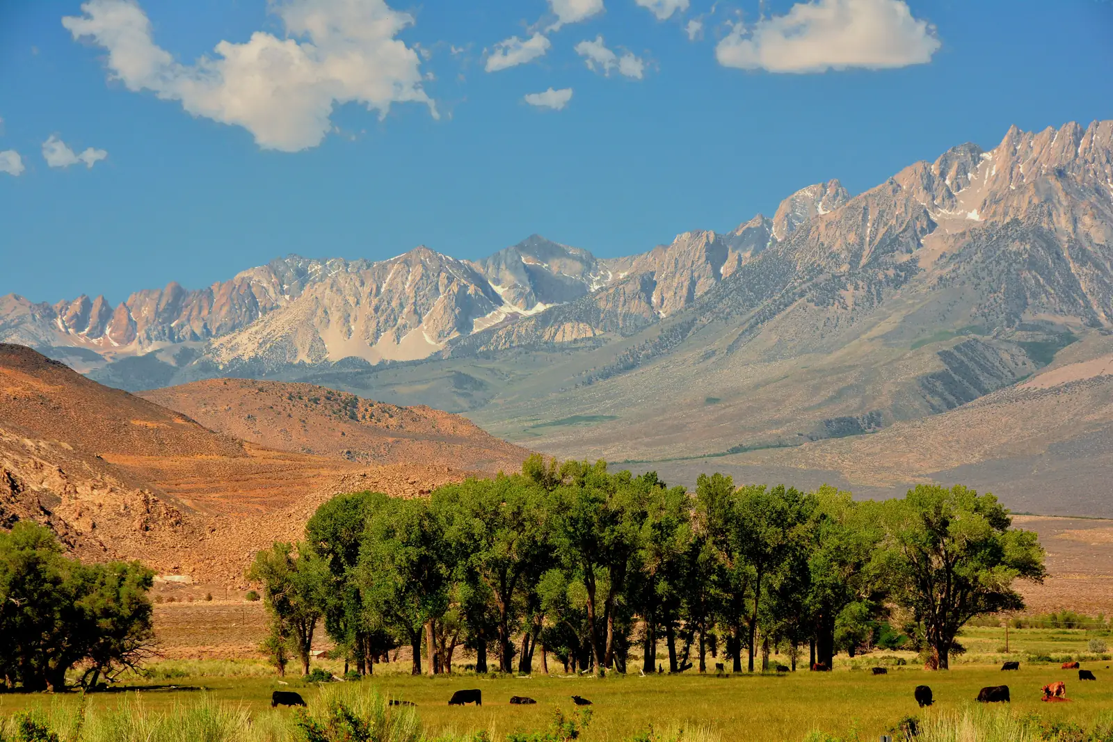
Bishop lies in the Owens Valley on US 395 between Mammoth Lakes and Lone Pine, with the Owens River, Hot Creek, Crowley Lake and the East Walker River along the same highway.
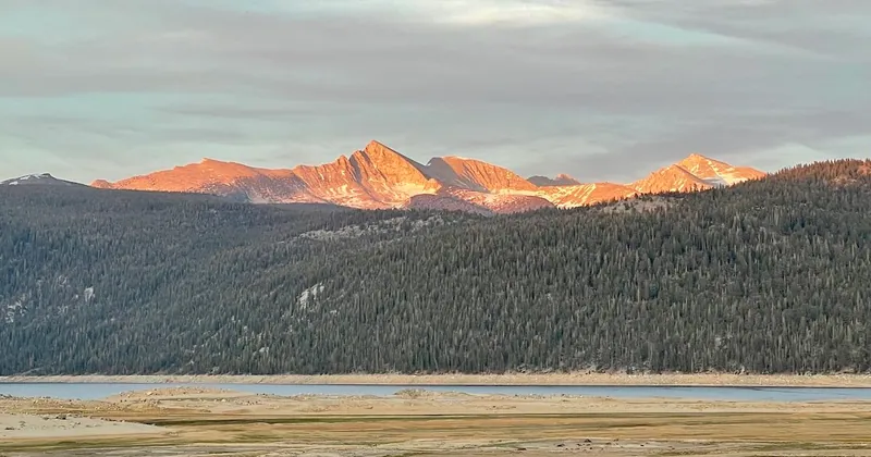
The eastern Sierra Nevada from the Owens Valley near Bishop. Photo: Mike McBey, CC BY 2.0, via Wikimedia Commons
Tap a water for its live flow, access map, regulations and hatches.
 Wild Trout Water
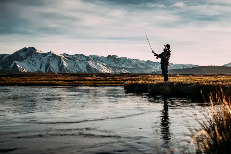
The upper Owens River in Mono County, California. Photo: Robson Hatsukami Morgan (via Unsplash), CC0, via Wikimedia Commons
California · 13 mi from Bishop
 Wild Trout Water
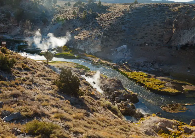
Hot Creek near Mammoth Lakes, with steam from geothermal springs. Photo: TheDailyNathan, CC BY-SA 3.0, via Wikimedia Commons
California · 31 mi from Bishop
 Lake or reservoir
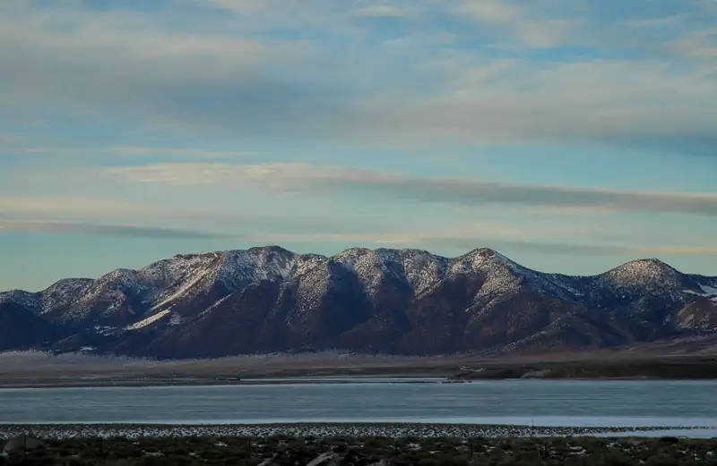
Crowley Lake and the Long Valley Caldera from US 395. Photo: Clinton Steeds, CC BY 2.0, via Wikimedia Commons
California · 26 mi from Bishop
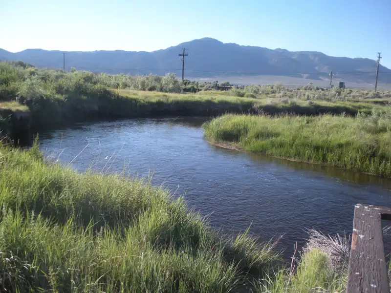 Tailwater
The East Walker River in Bridgeport, California. Photo: Ixfd64, CC BY-SA 4.0, via Wikimedia Commons
California · 75 mi from Bishop
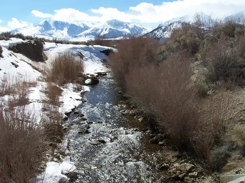 Freestone river
Rush Creek, Mono County, California. Photo: Greg Reis, CC BY-SA 3.0, via Wikimedia Commons
California · 50 mi from Bishop
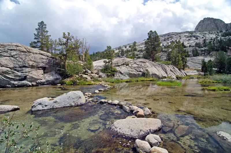 Freestone river
The Middle Fork of Bishop Creek, eastern Sierra. Photo: Scrubhiker (USCdyer), CC BY 2.0, via Wikimedia Commons
California · 4 mi from Bishop
The rivers, lakes or flats this hub is organised around, each with its straight-line distance from Bishop. Within 40 miles a water's own page names this hub as near; a farther one shows its distance instead. Where a nearby guide names a water on its own website, we say how many do. Access, seasons and special regulations differ by reach: check the agency pages under license and rules.
The first USGS gauge on each water: the latest reading, how it compares with that gauge's record for today's date, the 24-hour trend and the NWS flood stage. Open a water for what the level means.
8 guide listings within 75 miles (6 fly-focused), fly-focused first. Unclaimed listings say so on their page: confirm licensing, rates and dates with the outfitter.

Mammoth Lakes, CA · 24 mi
Lake & stillwater · Beginners & lessons · Crowley Lake
Mammoth Lakes, CA · 37 mi
Lake & stillwater · Multi-day trips · Pyramid Lake & Eagle Lake
4 shop listings in the towns around Bishop, fly shops first. Confirm hours with the shop before you go.
Taken from the state agency pages of 11 waters around Bishop, each on its own water page with the agency link. Seasons are quoted word for word and apply to the water named.
“The catch-and-release fisheries of the Upper Owens River above the Benton Bridge to Big Springs, the East Walker River below Bridgeport Reservoir, and Hot Creek, remain open year-round.”
Hot Creek · USDA Forest Service, read 2026-10-14
“The Lower Owens River outside of Bishop remains open year-round.”
Owens River · USDA Forest Service, read 2026-10-14
Counted from the species each guide lists on its own site. This is what guides advertise, not an agency species list or a promise of what you will catch. We hold no agency species page for this hub yet.
Fees on the agency page.
BIH Eastern Sierra Regional Airport · 2 mi
Seasons, limits and access: agency pages.
Buy the license from the agency and read its current regulations before you go. These links are the authoritative pages; nothing on this page grants or implies access to any water, and fees are only shown when read from the agency page on a stated date.
Nothing here grants or implies access to any water.
Near Bishop & the Eastern Sierra. Each fact comes from the business's own website, an official register or an approved claim; the listing page links the source.
The circle is the 75-mile area this page covers, around Bishop. Tap a water for its page. Shops and guides appear where they publish a street address on their own website; all of them are listed above.
Map of the Bishop & the Eastern Sierra area: its waters, shops and guides
Map of Bishop & the Eastern Sierra: the 75-mile area this page covers, its waters, and shops and guides with an exact address.
Restrooms within 5 miles of the centre of Bishop & the Eastern Sierra in a straight line, nearest first, with what anglers found when they went. The map says a restroom is there, not whether it is clean or open today.
Map of 8 restrooms near Bishop & the Eastern Sierra
Skip the map; every place is in the list belowMap of 8 restrooms near Bishop & the Eastern Sierra, numbered as in the list, with the town centre marked.
Not rated yet — be the first to tell other anglers if it's clean.
Mapped on OpenStreetMap · see or fix it on the map
Not rated yet — be the first to tell other anglers if it's clean.
Mapped on OpenStreetMap · see or fix it on the map
Not rated yet — be the first to tell other anglers if it's clean.
Mapped on OpenStreetMap · see or fix it on the map
Not rated yet — be the first to tell other anglers if it's clean.
Mapped on OpenStreetMap · see or fix it on the map
Not rated yet — be the first to tell other anglers if it's clean.
Mapped on OpenStreetMap · see or fix it on the map
Not rated yet — be the first to tell other anglers if it's clean.
Mapped on OpenStreetMap · see or fix it on the map
Not rated yet — be the first to tell other anglers if it's clean.
Mapped on OpenStreetMap · see or fix it on the map
Not rated yet — be the first to tell other anglers if it's clean.
Mapped on OpenStreetMap · see or fix it on the map
Restroom locations and map details: © OpenStreetMap contributors, Open Database License, read Oct 24, 2026. Ratings, answers and photos are members' own; who shared them is never shown, and every photo is reviewed before it appears. Visits older than 18 months no longer count. Distances are straight-line miles, not driving. Nothing here grants access to private land. Community guidelines.
Bishop is the valley town with year-round services; Mammoth Lakes is the resort town up the hill with more lodging. We do not list or price properties. The search opens an outside site.
Distances are straight-line from the town centre, computed from OurAirports open data; distances by road are longer. Fares are never estimated here.
Set nights, anglers and guided days. Each line says where its figure comes from, and anything we cannot source honestly (guide rates, fares, license fees not read from the agency page) stays a link rather than a number.
Estimates, not quotes
One per angler (2 anglers). Fees are set by California Department of Fish and Wildlife; see the agency page.
Source: California Department of Fish and Wildlife1 guided day for 2 anglers. We do not copy guide rates: 3 guides near here publish a rates page on their own website.
Source: Guide websites (rates pages linked, never copied)Search places to stay near the destination. We do not list or price properties.
Source: Lodging search linkFares are not estimated here. Search flights to BIH (Eastern Sierra Regional Airport).
Source: Flight search link (no fares quoted)No priced itemsUse the links for real figures.
Estimates, not quotes. Nothing here is a price from a guide, a property or an airline; confirm every cost with the provider before you book. No placeholder lodging range is configured for this region, and licenses, guided days and flights are never priced here.
For the non-fishing days, or the people traveling with you. Official sources only; what to do there is for their pages to say.
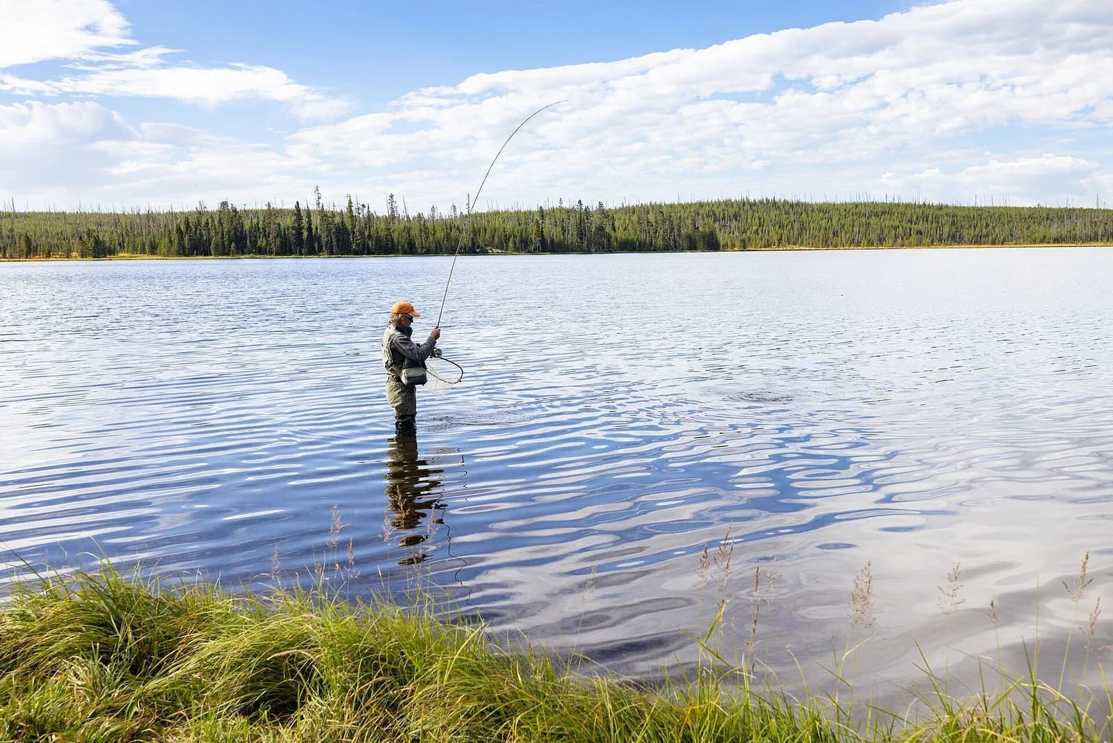
A stillwater fly-fishing checklist for lakes and ponds: a 9–10 ft 5–6 weight rod, floating and intermediate lines, chironomids and leeches, and float-tube options, with estimated prices and where to buy.
9′–10′ rod, 5–6 weight, floating + intermediate lines · Rainbow, brook and brown trout in lakes
Open checklistChironomids, leeches and where fish hold in a lake.
Public YouTube videos from established channels, chosen by us to support this page. Not sponsored; the creators are not affiliated with Legendary Fly Gear.
Not sponsored All videos on stillwater
Trip stories anglers chose to share publicly, tagged with a water in California.
No California stories yet.
Guide and shop listings come from the Legendary directories (open map records checked against each business’s own website). Everything else links to the publisher below; this page copies none of their text. A destination hub organises discovery; it does not assert public access, current fish presence, guide availability or fishing conditions.
Links checked 13 Oct 2026. Not a claim of access or conditions.
Wild Trout WaterThe upper Owens River in Mono County, California. Photo: Robson Hatsukami Morgan (via Unsplash), CC0, via Wikimedia Commons
California · 13 mi from Bishop
Wild Trout WaterHot Creek near Mammoth Lakes, with steam from geothermal springs. Photo: TheDailyNathan, CC BY-SA 3.0, via Wikimedia Commons
California · 31 mi from Bishop
Lake or reservoirCrowley Lake and the Long Valley Caldera from US 395. Photo: Clinton Steeds, CC BY 2.0, via Wikimedia Commons
California · 26 mi from Bishop
TailwaterThe East Walker River in Bridgeport, California. Photo: Ixfd64, CC BY-SA 4.0, via Wikimedia Commons
California · 75 mi from Bishop
Freestone riverRush Creek, Mono County, California. Photo: Greg Reis, CC BY-SA 3.0, via Wikimedia Commons
California · 50 mi from Bishop
Freestone riverThe Middle Fork of Bishop Creek, eastern Sierra. Photo: Scrubhiker (USCdyer), CC BY 2.0, via Wikimedia Commons
California · 4 mi from Bishop
Big Pine, California
Fishing lodge · 15 mi
Mammoth Lakes, California
Fishing lodge · 19 mi
Crowley Lake, California
Fish camp · 24 mi
Mammoth Lakes, California
RV park · 26 mi
June Lake, California
River cabins · 48 mi
Yosemite National Park, California
Fishing lodge · 71 mi